About Lake Max
Lake Maxinkuckee, the second largest natural lake in the state of Indiana, covers 1,864 acres. Located in the town of Culver, in the southwest corner of Marshall County, the lake is 2.6 miles long and 1.6 miles wide, with an average depth of 24 ft. and a maximum depth of 88 feet. The lake is fed by 21 underground springs stemming from the productive Silurian-Devonian bedrock aquifer, which lies beneath the lake.
Watch this 10 minute video (below) to learn more about Lake Maxinkuckee’s tributaries and wetlands.
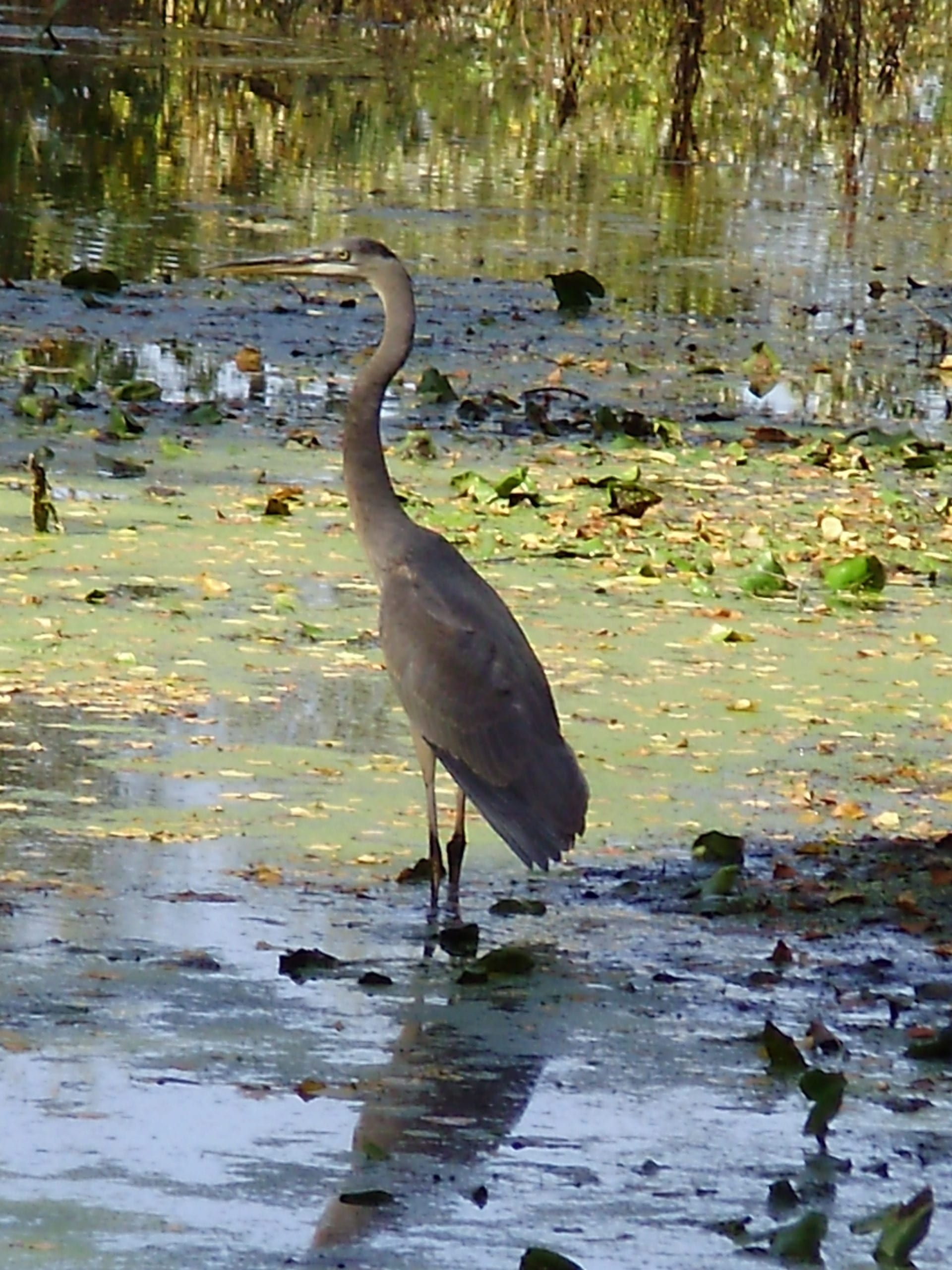
Lake Maxinkuckee Wetlands
Wetlands play an integral role in the water quality of Lake Maxinkuckee. After being slowed by a wetland, water moves around plants, allowing the suspended sediment to drop out and settle to the wetland floor. Nutrients from fertilizer application, manure, leaking septic tanks, etc. that are dissolved in the water are often absorbed by plant roots and microorganisms in the soil.
Other pollutants stick to soil particles. In many cases, this filtration process removes much of the water’s nutrient and pollutant load by the time it leaves a wetland. In addition to improved water quality, wetlands are also considered the most biologically diverse of all ecosystems, serving as home to a wide range of plant and animal life.
Like a lot of lakes over time, Lake Maxinkuckee had lost many of its wetlands due to development and agricultural drainage.
Wetlands…
- Provide fish and wildlife food and habitats
- Improve water quality
- Protect against floods
- Protect against erosion
Curtis Wetland
Kline Wetland
Wilson Wetland
Wilson Wetland
With fewer wetlands, the lake was affected by fertilizer-laden sediment and other pollutants entering the watershed from a variety of sources. In 1987, LMEC volunteer members, concerned citizens, farmers and community leaders joined with the Department of Natural Resources Division of Fish and Wildlife, along with the Division of Soil Conservation’s Lake and River Enhancement Program, to build the Wilson Wetland, Indiana’s first man-made wetland.
This wetland sits on the Wilson Ditch, which begins in surrounding farm fields in the east, then runs west and northward into property owned by the Culver Military Academy at the northeast corner of St. Rt. 10 and Queen Road. There the ditch passes through the wetland, then turns west into the CMA bird sanctuary on the west side of Queen Road. After leaving the bird sanctuary, it crosses back south across St. Rt. 10 and continues along County Road 117, jogging west into Lake Maxinkuckee. The Wilson carries water from 1,700 acres north and east of Lake Maxinkuckee.
In 2007, this important wetland was saved, through the efforts of the Indiana Department of Environmental Management and the LMEC, when an Indiana Department of Transportation project changed the configuration of the intersection of Queen Road and State Road 10. The ditch was widened south of the intersection and the culvert running under State Road 10 replaced. Great care was taken to protect the wetland, downstream from the ditch reconstruction, from disturbed sediment entering the stream. A stream bank planting plan was approved by LMEC to encourage bank stabilization. Unfortunately, the project was just completed when the Culver area had one of its hardest winters in years. On January 1, 2008, the ditch bank walls collapsed from the snow and heavy flow through the ditch, rolling the core logs into the stream. The wetland was rebuilt in 2008 courtesy of the Culver Academies.
The Wilson Ditch is one of the three main tributaries into Lake Maxinkuckee. It is tested regularly by LMEC for water quality. The wetland is maintained under the supervision of the LMEC, by our partners at Culver Military
Academy.
Curtis Wetland
East of the lake, the 12 acre Curtis Wetland, completed in early 1990, was the second wetland built under the direction of the LMEC. It is similar to the Wilson, in that it originally was pasture land, not a wetland. The IDNR’s Lake and River Enhancement (LARE) program provided the majority of the project costs, with the balance being raised locally by the LMEF. Sediment traps were installed upstream to remove larger sediment particles before the water enters the wetland. Five islands and three baffles were built to direct the flow of water and increase retention time.
The Curtis Ditch runs from a farm to the east, passes through the wetland, then continues west into Lake Maxinkuckee, draining 1,563 acres in the eastern portion of the watershed. Annual water sampling shows us that water flowing into the lake from this wetland is very low in pollutants, which is proof that the wetland is working!
Maintenance on this wetland is primarily provided by LMEC volunteers and the property owner. Controlling highly invasive phragmites is an ongoing concern, as well as monitoring the flow of water and removing beaver dams.
This wetland is privately owned and the LMEC is very fortunate to have such a strong partner in protecting the water quality of Lake Maxinkuckee.
Kline Wetland
This wetland, also known as the Maxinkuckee Wetland and Conservation Area, was reconstructed by LMEC and IDNR in 1992, filtering watershed runoff from 1,900 acres southeast of the lake. It includes sediment traps, baffles, islands, a levee and wetland plantings. Design and construction costs were paid for by the Culver Educational Foundation.
Prior to the construction of the wetland, a small cattle farm was located on the land. In keeping with current thinking at the time, the stream was straightened to dry out the farm fields more quickly after a rain and to dry out the marshy area. However, this allowed pollution, in the form of cattle waste, as well as agricultural field fertilizers, to drain more quickly into the lake. Subsequent dredging of the channels in Venetian Village added sediment pollution. Unfortunately, while LMEC was realigning the stream back to a more meandering, natural path, a heavy
rain washed a large amount of sediment from the golf course construction into the newly built wetland.
This 80-acre wetland, owned by the IDNR, with stewardship granted to the LMEC, is a great public space. Hiking, hunting, trapping and fishing take place here year-round. Water sampling is done several times per year, courtesy of LMEC, to monitor for water quality. Beaver damage is also managed by LMEC.
However, time has taken its toll on this wetland. The Kline levee has been breached several times over the years, resulting in low water levels and very little flowing water. In 2019 a fundraising campaign was undertaken to rebuild the levee. Once completed, the wetland water levels will return to a functioning level.
Get In Touch
Call
574-842-3686
Address
PO Box 187
116 N Main St
Culver, IN 46511
Hours
Mon - Fri: 9am - 4pm
* The office is occasionally closed during these hours due to outreach events and work outside the office