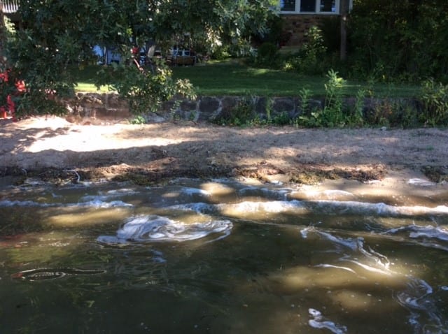
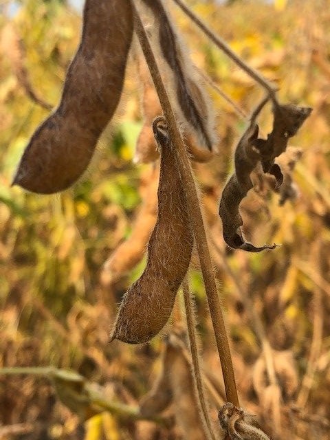
We don’t need data from the National Weather Service to know that it is DRY! From brown lawns to desiccated soybean fields to exposed shorelines, everything is parched. We need a good, soaking rain. The forecast looks hopeful for this week.
Lake Impact
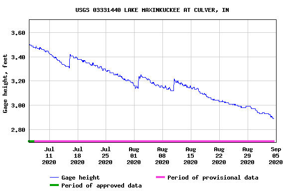
I have had several people comment to me that the lake is quite low. So, I thought I would check to see if data would support that observation. The United States Geological Survey (USGS) has a gage station to measure the lake level. It is jointly funded by LMEF, Culver Academies and the Town of Culver. I found some interesting data.

Historic Lake Levels on September 4th:
- 2015 3.3’
- 2016 3.4’
- 2017 3.0’
- 2018 3.2’
- 2019 3.5’
- 2020 2.9’

So, yes, data supports that the level of the lake is down and is actually at its lowest point on this date in the last 5 years, but not by a lot.
I thought I would see what has happened to the lake level over the past few months. Interesting to see the rain events but exactly what I expected to see. Bottom line, the lake gage is a good tool to monitor trends. It is important information to have but is just one piece of the puzzle in determining the overall health of the lake.
I was also asked if the construction at the Kline Levee contributing to the low lake level. Great question and the answer is no. Lake Maxinkuckee is spring fed, and depending on the depth of the springs, may or may not be affected by drought. In addition, several temporary culverts were installed during construction to allow for water flow from the wetland into the lake while the levee was under construction.
Agricultural Impacts
Even though we are experiencing very dry conditions and the corn and soybean fields are looking pretty parched, Purdue Extension reported an optimistic outlook.
“All in all, the 2020 growing season has been more ‘normal’ than many recent years,” says Bob Nielsen, Purdue professor of agronomy and Extension expert in Indiana’s corn management systems. “We are hopeful that we will have a good harvest season, which would be a welcome relief compared to the statewide late harvest last year.”

Statewide soybean yield is projected to reach a record 61 bushels per acre compared to 51 bushels per acre in 2019. Corn forecasts expect a statewide yield of 188 bushels per acre in Indiana, which is up from 169 bushels per acre in 2019. As of August 1, 67 percent of corn was rated good to excellent.
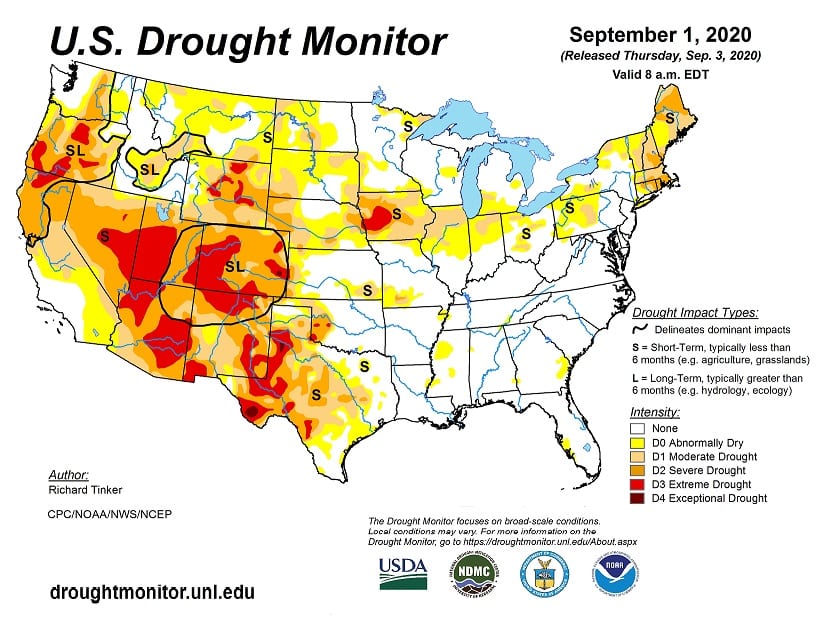
US Drought Monitor, classifies our area as D1 – Moderate Drought. The surrounding areas are classified as D0 – Abnormally Dry while the rest of the state is not registering as dry. Our local yields will probably not be as high as the statewide average that are projected.
Fun Fact
According to Agricultural Productivity in the United States USDA Economic Research Service, U.S. farmers today use 15% less water than they did in 1980,
and produce a 70% larger harvest!
What About Wetlands?
With these dry conditions the wetlands are drying up as well. But this doesn’t mean that they are no longer a wetland! The presence of water is just one of the characteristics in determining whether a piece of property is a wetland. Soil type is an important factor as well as the type of plant material growing there. Wetlands must be protected, even when they are not wet! Here is a short video that explains wetlands and types of wetlands.
When the well is dry, we will know the worth of water ~ Benjamin Franklin
Recommended reading: “The Big Thirst The Secret Life and Turbulent Future of Water” by Charles Fishman. This book explains the golden age of water and shows that we’ve already left behind thoughtlessly abundant, free, and safe water, but also that as dramatic as the challenges are, we have all the means we need to meet them. The hardest part is changing our water consciousness.
Want to move forward in your conservation journey? Check out Clear Choices Clean Water and make a pledge!

Hi, I’m Debbie Palmer. I received a BS in Horticulture from Purdue University. Here at LMEF, I am responsible for outreach presentations, monitoring the lake and it’s wetlands, project manager for restoration and research projects, and act as a community resource for all things related to the well-being of Lake Maxinkuckee and its surrounding watershed. I completed Indiana Watershed Leadership Academy, volunteer with the Indiana Clean Lakes Program, Hoosier River Watch and Marshall County Lakes and Waters and serve as a Board Member for Indiana Lakes Management Society.


Great blog – thanks tons! It does seem so much lower- but interesting that it is just a hair lower than normal!
Thanks for the care and science. Well written!
Thank you for your feedback.
I am so glad you post these fascinating bits of information. I look forward to them.
I always appreciate feedback. Thank you.
Thank you Debbie. Your information is always helpful.