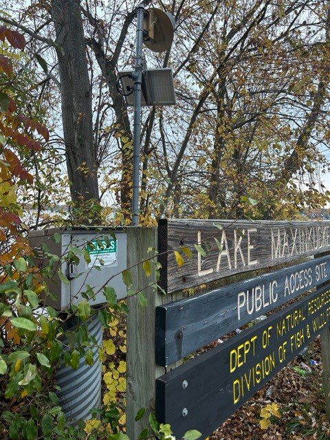
At a recent meeting, I was surprised to learn that several people were unaware that there is a gauge on the west shore of Lake Maxinkuckee that tracks the level of the lake. It is quite interesting to compare the level of the lake over time and more people should know about it.
Per the 2015 Funding Agreement
“The Indiana Department of Natural Resources (DNR) and The United States Geographis Survey (USGS) have maintained a gauge near the DNR public landing on Lake Maxinkuckee as part of its monitoring the Lake Maxinkuckee water level and other hydrologic matters pertaining to the lake and the surrounding area. DNR will cease to provide funding for the gauge as of October 1, 2015.”
Rather than lose an important piece of data collection, LMEF, Culver Academies and the Town of Culver entered into a joint agreement with USGS to continue to fund the cost of operating and maintaining the gauge. The annual cost for each entity has been $1,333.00, with the cost increasing to $1,400 in 2024.

Why Measure Lake Level
Lakeshore properties can be adversely affected by lake level fluctuations such as flooding damage, drought-related access problems, and aesthetics. Knowing and understanding the history of lake levels can help shoreland owners and others who use the lake be better prepared to cope with the natural fluctuations of the lake.
In addition, historical lake level data can be useful in developing computer simulations of lake fluctuations. The data could be used to estimate flood levels and to establish low-floor elevations for construction. The data could also be used to help determine the ordinary high-water levels. Watershed managers and planners could use historical lake level data to prepare local water management plans and to model water quality characteristics on the lake.
The Data Is What It Is
I often hear people comment on the level of the lake when it seems unusually high or low. This is an example of anecdotal information which could be helpful but should not be relied upon when making management decisions.
an·ec·do·tal
ADJECTIVE
not necessarily true or reliable, because based on personal accounts rather than facts or research
The lake gauge allows anyone to log into the USGS site to see accurate and reliable data. If you follow me, you know that I already touched on this in Fun with Facts and Figures. Having access to this data gives us one more tool in the toolbox to make informed decisions.
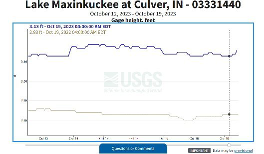
If you like to geek out on data and think it’s fun to see how high or low the lake was in the past compared to today, check out Lake Maxinkuckee at Culver, IN – USGS Water Data for the Nation. With the click of one button, I added data from 2022 to the graph to compare this year to last year. Or you could monitor the lake height after storm events or during a drought. The possibilities are limitless!
“In God we trust. All others must bring data.“
Ginni Rometty
Chairman, President and CEO of IBM

Hi, I’m Debbie Palmer. I received a BS in Horticulture from Purdue University. Here at LMEF, I am responsible for outreach presentations, monitoring the lake and it’s wetlands, project manager for restoration and research projects, and act as a community resource for all things related to the well-being of Lake Maxinkuckee and its surrounding watershed. I completed Indiana Watershed Leadership Academy, volunteer with the Indiana Clean Lakes Program, Hoosier River Watch and Marshall County Lakes and Waters and serve as a Board Member for Indiana Lakes Management Society.
Recent Comments